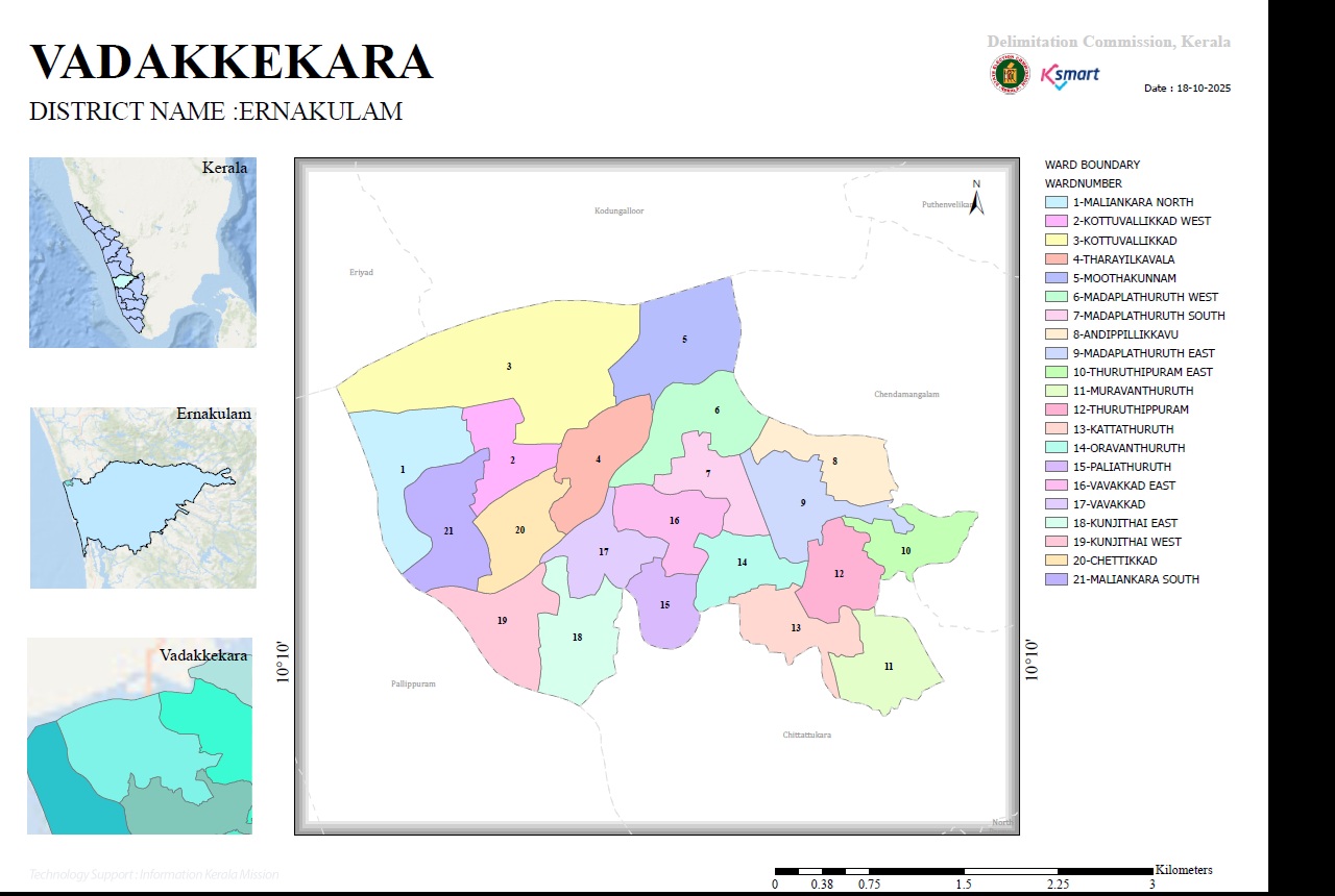
WARD MAP
🗺️ Ward Map
2025 Ward Delimitation Map
This is the official interactive ward map prepared for Vadakkekkara Grama Panchayat using Geographic Information System (GIS) technology as part of the 2025 ward delimitation process in Local Self-Government Institutions across Kerala.
This digital map helps the public clearly understand ward boundaries and access geographical information about different areas.
Legal Information
As per Section 10 of the Kerala Panchayat Raj Act, 1994, Vadakkekkara Grama Panchayat has been divided into 21 constituencies, with their respective boundaries officially determined.
The final order issued by the Hon'ble Delimitation Commission, along with the officially published final map, can be accessed here.
Digital Map Services
The GIS-based interactive map enables users to easily understand the boundaries of each ward, geographical areas and related location information.
The map provides easy access to ward-wise information for the general public, researchers and project implementation officials.
📌 Important Information
The 2025 ward delimitation map is intended to provide the public with clear information about the officially determined ward boundaries of Vadakkekkara Grama Panchayat.